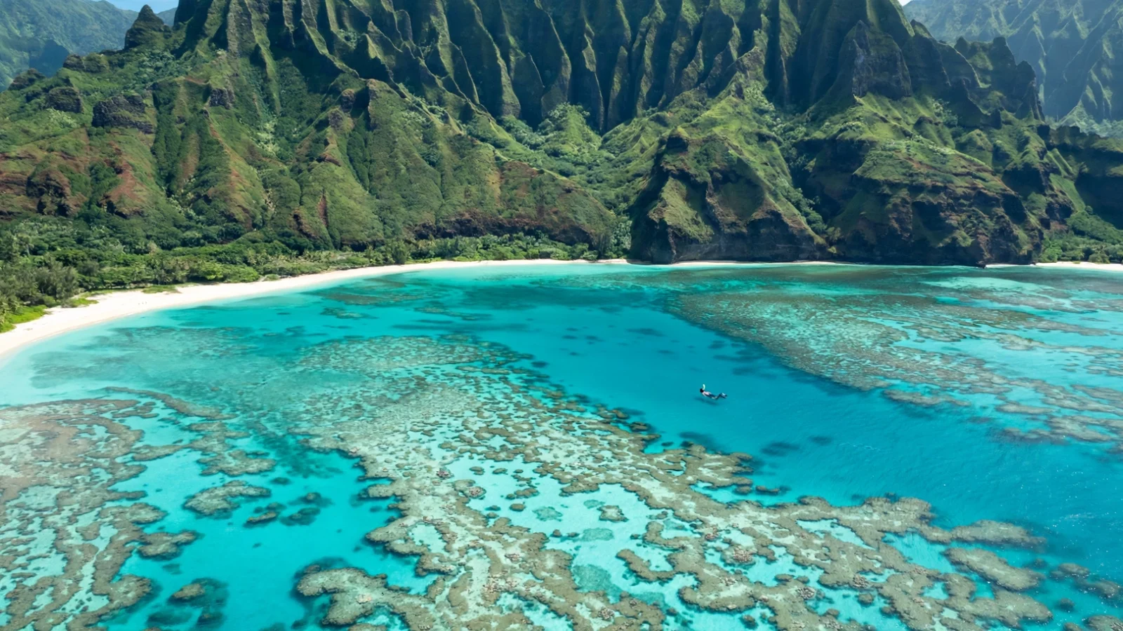
The short answer: Kauai’s snorkeling is a seasonal island, and the map below pins all 19 shore spots with GPS coordinates, a difficulty rating, and an honest verdict — so you can see exactly where each reef sits before you drive there. The north shore rules in summer, the south shore carries the winter, and the east side fills the gaps year-round on calm mornings. Every spot below links to our full guide for that beach.
How to read this Kauai snorkeling map
Kauai’s snorkeling follows the swells, and more than any other island, the season decides the beach. The north shore (Ke’e to Kalihiwai) faces the open Pacific and is a summer-only snorkel coast — calm May through September, dangerous the rest of the year. The south shore (Mahaulepu to Koloa Landing) is sheltered year-round and is the winter default. The east side (Anahola to Lydgate) is the year-round middle ground: protected by fringing reef but sensitive to rain and trade-wind chop. The west side is basically one pin — Salt Pond — calm on flat days, wild the rest.
Two rules run the whole map:
- North = check the surf first. Winter swells (roughly October–March) can make every pin from Ke’e to Secret Beach unswimmable. In winter, default to the south shore and the protected east-side spots.
- Mornings are calmest everywhere. Trade winds build through the afternoon, so plan shore entries before about 11am year-round.
For the full seasonal breakdown, see our best time to snorkel in Hawaii guide, and for the ranked list behind these pins, the Kauai snorkeling hub. Our which side of Kauai is best for snorkeling page covers the seasonal side-by-side in detail.
The full Kauai snorkeling map: every spot with GPS pins
Nineteen shore spots, pinned clockwise from the north shore’s west end around to the west side. Paste any coordinate pair into Google Maps to drop a pin on the exact entry area. Difficulty is rated for a reasonably fit adult swimmer on a calm morning: Beginner = sandy entry, shallow reef, lifeguard often present; Intermediate = rocky entry, deeper water, trail access, or surge to respect; Poor = honest no-go verdicts we include so you don’t waste a drive.
| # | Spot | Coast | GPS | Difficulty | Best for | Guide |
|---|---|---|---|---|---|---|
| 1 | Ke’e Beach | North | 22.2195, -159.5660 | Beginner–Intermediate | End-of-the-road reef; parking permit needed | Ke’e guide |
| 2 | Tunnels Beach | North | 22.2027, -159.4977 | Intermediate | Kauai’s best reef; lava tubes | Tunnels guide |
| 3 | Hanalei Bay (Black Pot) | North | 22.2130, -159.4961 | Beginner (summer) | Calm summer crescent; pier end | Hanalei guide |
| 4 | Hideaways Beach | North | 22.2206, -159.4971 | Intermediate (steep trail) | Secluded Princeville cove | Hideaways guide |
| 5 | Anini Beach | North | 22.2230, -159.4685 | Beginner | Calm lagoon; turtles | Anini guide |
| 6 | Kalihiwai Beach | North | 22.2164, -159.4263 | Beginner–Intermediate | Quiet bay; stream mouth to avoid | Kalihiwai guide |
| 7 | Secret Beach (Kauapea) | North | 22.2206, -159.4082 | Intermediate (trail) | Wild, unguarded beach; strong currents | Secret Beach guide |
| 8 | Larsen’s Beach | East | 22.1956, -159.3494 | Intermediate | Remote reef; rip currents | Larsen’s guide |
| 9 | Moloaa Bay | East | 22.1880, -159.3350 | Intermediate | Ends-only reef; stream rule | Moloaa guide |
| 10 | Anahola Beach | East | 22.1404, -159.3008 | Beginner–Intermediate | Fringing reef; rain visibility | Anahola guide |
| 11 | Lydgate Beach Park | East | 22.0372, -159.3365 | Beginner | Rock-walled pool; best rough-day option | Lydgate guide |
| 12 | Kalapaki Beach | East | 21.9622, -159.3499 | Poor | Pretty bay — not a snorkel beach | Kalapaki guide |
| 13 | Mahaulepu Beach | South | 21.8926, -159.4109 | Intermediate | Wild hike-in beach | Mahaulepu guide |
| 14 | Shipwreck Beach | South | 21.8765, -159.4425 | Intermediate | Near-shore reef; watch the shorebreak | Shipwreck guide |
| 15 | Brennecke’s Beach | South | 21.8739, -159.4535 | Intermediate | Poipu’s surf-side reef | Brennecke’s guide |
| 16 | Poipu Beach | South | 21.8741, -159.4552 | Beginner | Kauai’s easiest famous snorkel; turtles | Poipu guide |
| 17 | Koloa Landing | South | 21.8803, -159.4659 | Beginner–Intermediate | Shore-dive favorite; clear water | Koloa Landing guide |
| 18 | Lawai Beach (Beach House) | South | 21.8816, -159.4758 | Beginner–Intermediate | Two-zone reef; sheltered side is easy | Lawai guide |
| 19 | Salt Pond Beach Park | West | 21.9007, -159.6078 | Beginner | West side’s calm exception | Salt Pond guide |
North shore snorkeling map: Ke’e to Kalihiwai
Seven of the nineteen pins sit on the north shore — and every one of them is seasonal. Tunnels Beach (#2) is Kauai’s best reef snorkel when it’s calm: the underwater lava tubes that give it its name, entered over sand — bring booties for the reef edges. Next-door Ke’e (#1) at the end of the road is the gentler sibling, but parking permits sell out fast in summer.
Hanalei Bay (#3) in summer is a giant calm crescent with easy snorkeling off Black Pot at the pier end. In winter it’s a famous surf spot: do not enter. Hideaways (#4) is the Princeville seclusion pick — beautiful, but the steep trail access and unguarded water make it an intermediate call. Anini (#5) is the north shore’s beginner gift: a long shallow lagoon reef behind one of Hawaii’s biggest barrier reefs, calm even on days when the shore breaks are up, and regular turtles.
The quieter east end of the shore rewards early birds: Kalihiwai (#6) is a small bay with a stream mouth to stay clear of, and Secret Beach (#7) is wild and gorgeous — and genuinely the most current-prone pin on this map. Summer mornings before 10am are the window for all seven.
East side: Larsen’s to Lydgate
The east side is Kauai’s year-round middle ground, protected by fringing reef but moodier than the sand color suggests. Larsen’s (#8) and Moloaa (#9) are the quiet conditional pair — remote, reef at the ends only, and both governed by the stream rule: after rain, stay out of the stream-mouth water. Anahola (#10) is the east side’s local snorkel beach with a lifeguard and facilities; its visibility is the rain switch, not the calendar.
Lydgate (#11) is the island’s great equalizer: a rock-walled enclosed pool with fish inside the wall and almost no ocean energy — the best rough-day snorkel on Kauai and the easiest beginner water on this map. Kalapaki (#12) is our honest no-go: a pretty Lihue bay with no real offshore reef. We pin it so you don’t drive there expecting a snorkel.
South shore and west side: Mahaulepu to Salt Pond
The south shore is where most visitors actually snorkel, and it’s the winter default. Poipu (#16) is Kauai’s easiest famous snorkel: shallow, calm, turtles on most visits. Koloa Landing (#17) is the shore divers’ favorite — clear water and a gentle slope. Lawai (#18) has two personalities: the sheltered Beach House side is beginner-friendly, the far side has a rip current — our Lawai guide explains the split.
Brennecke’s (#15) and Shipwreck (#14) are the surf-adjacent pair: good reef near shore, but both punish inattention at the shorebreak. Mahaulepu (#13) is the wild one — a hike-in beach with a Gillin’s-beach feel, worth it on calm days, skip it when the wind is up. Salt Pond (#19) is the west side’s only pin: a protected reef on a coast that is mostly not snorkelable.
Boat-only spots (no shore pin)
Kauai’s best-kept secret isn’t on this map’s pins at all. The Na Pali Coast reefs and the Ni’ihau–Lehua channel hold the clearest water and healthiest coral on the island, but they’re boat-only — a day trip with a tour operator. For choosing between boat and shore, see Hawaii snorkeling tours. Everything pinned above is a free shore entry — no tour needed.
Where to snorkel on Kauai this month
Use the map with this seasonal cheat sheet. It’s a pattern, not a forecast — always check the day’s surf and wind before entering.
| Months | Go here | Avoid / caution |
|---|---|---|
| May – September | Everywhere: North Shore at its calmest (pins 1–7), plus south and east | Afternoon trade-wind chop — go before 11am |
| October, April | South shore (Poipu, Koloa, Lawai), Lydgate, Anahola, Salt Pond | First/last swells can reach the North Shore |
| November – March | South shore first (pins 13–18), Lydgate, Salt Pond on flat days | North Shore (pins 1–7), Larsen’s, Moloaa, Secret Beach during swells |
New to the sport? Start with our beginners guide and how-to-snorkel primer, and read Hawaii snorkeling safety before any rocky entry. Turtles are everywhere on this map — the rules for watching them are in snorkeling with turtles (stay 10 feet back, never touch).
Kauai snorkeling map FAQ
Is there a free Kauai snorkeling map?
Yes — this page is one. The pin table above gives you GPS coordinates for all 19 shore spots free; paste any pair into Google Maps to navigate to the entry. Rental shops sell paper snorkel maps, but they’re designed to sell gear, not to rank spots honestly.
Where is the best snorkeling on Kauai?
On the map: Tunnels Beach (#2) for the best reef, Poipu (#16) for the easiest snorkel, Lydgate (#11) for beginners and rough days, and Anini (#5) for the calmest lagoon. The north shore (pins 1–7) wins in summer; the south shore wins in winter.
What is the best beach in Kauai for snorkeling for beginners?
Lydgate Beach Park, Poipu Beach, Anini Beach, and Salt Pond Beach Park — protected water, easy entries, and lifeguards at several. All are pinned above with beginner ratings.
Can you snorkel from shore on Kauai, or do you need a tour?
Almost everything on this map is a free shore entry — no tour needed. The exceptions are the Na Pali Coast and Ni’ihau–Lehua reefs, which are boat-only. If you want a guided trip anyway, our gear checklist covers what to bring.
Which side of Kauai is best for snorkeling?
It depends on the season. The north shore (pins 1–7) is best May–September. November–March, the south shore (Poipu to Koloa Landing) is the call. The east side (pins 8–11) is the year-round backup on calm mornings. Our which-side-of-Kauai guide compares the coasts in detail.
Where do you see turtles snorkeling in Kauai?
Poipu (#16) is the turtle guarantee, Anini (#5) and Lawai (#18) get regular sightings, and Prince Kuhio-area water near Brennecke’s is turtle territory too. Stay at least 10 feet away — it’s federal law.
Is snorkeling good in Kauai in December?
Yes, on the south and east sides. December swells shut down the north shore, but Poipu, Koloa Landing, Lawai, Lydgate and Salt Pond stay calm. Go in the morning before the trades build.
Can I download or print this Kauai snorkeling map?
There is no PDF download — but the GPS table above works better than a static printout. Paste any coordinate pair into Google Maps to drop a pin on the exact entry, and save those pins to a custom list for offline use on the beach. The seasonal table tells you which pins are in season for your travel month.
Do I need reef-safe sunscreen on Kauai?
Yes — Hawaii bans sunscreens with oxybenzone and octinoxate. See our reef-safe sunscreen guide for what to buy.
How we built this map
Every pin on this map corresponds to a spot we’ve covered in a dedicated guide on this site — no scraped, unverified pins. GPS coordinates were geocoded and verified against mapping data in October 2026. Difficulty ratings reflect entry type, typical conditions, and lifeguard presence on a calm morning. Spots we rate “Poor” stay on the map deliberately: a map that only shows the good spots sends people to the bad ones by omission. Our full process is documented in our methodology.